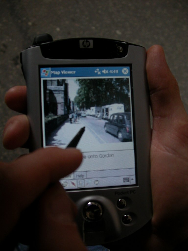
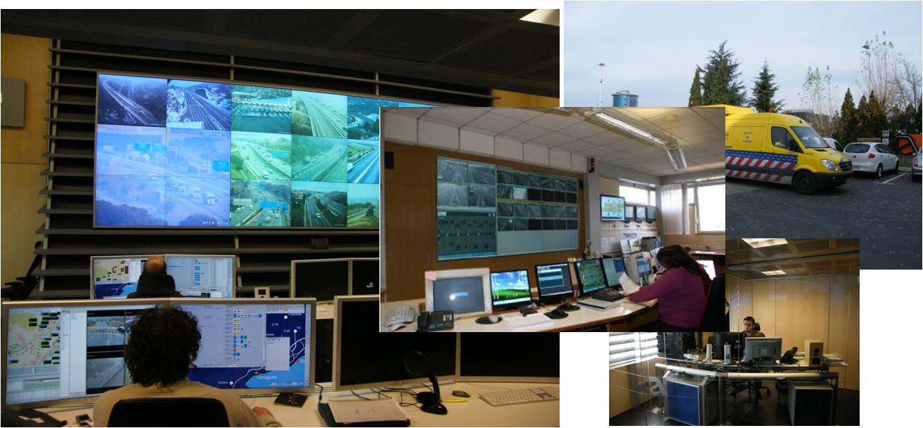
SafeTRIP
[2009-Current]
I am the lead investigator at UCL and product owner on the large scale
EC co-funded FP7 R&D project SafeTRIP (overall budget €11
million).
In addition, I am responsible for the following:
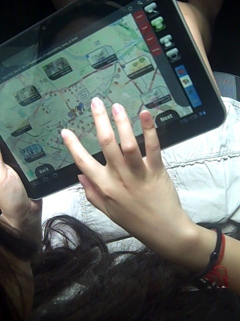
• User Requirements
• Managing development of 2 services
(Info
Explorer and Driver Alertness)
• Managing the assessment
of trials (User, Commercial,
Safety,
Security & Environment aspects)
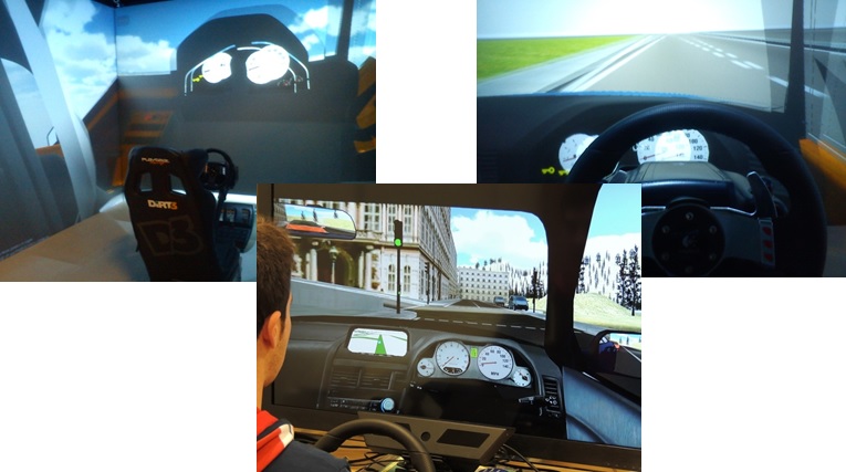
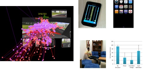
• Managing the development of a driving simulator for driver
attention/distration studies
• Dissemination activities
(publications, tutorial development and cross-fertilisation)
The SafeTRIP project has a consortium of 20 EU companies and
organisations, bringing
together Service operators, Road operators, Telecommunication providers
and other academic and technical partners. For more details see the
website
here.
The SafeTRIP
(Safellite
Applications For Emergency handling,
Traffic
alerts, Road safety and Incident Prevention) project's general
objective is to improve the use of road
and transport infrastructures and to improve the alert chain in case of
incidents. SAFETRIP benefits from a new satellite technology: the
S-Band that is optimised for 2-way communications for on-board vehicle
units interoperable with Galileo and UMTS systems.
| The SafeTRIP platform
architecture |
|
User Requirement capture |

|
|
|
|
|
|
| Defining SafeTRIP services |
|
Info Explorer - Design,
Implementation and Testing |

|
|

|
|
|
|
| Driving Simulator |
|
Scientific Studies |
 |
|
 |
ARVA
[2008-2009]
The project centered around the
development of an Augmented Reality
(AR) system to visualise and interact with 3D CAD models in-situ -
using a tablet PC on construction sites.
Essential components of the system included
• Visualisation module for building plans in 3d on a mobile
device
• Tracking
module to augment the real world with planning
information in real time
• Annotation module to record multimedia information (video,
audio and images) and associate these with the plans
It was funded by the EPSRC
RAIS scheme to perform the ground work in collaboration with Laing
O'Rourke at the Cannon Street Station construction site.
SESAME
[2007]
This
WINES project
involved several institutions -
I collaborated
with UWIC and the RVC in my work. My
research centered around the capture and production of customizable
computer animation for
athletics.
I used data
captured from olympic sprinters by various data capture techniques.
Challenges lie in the data capture and animation of fast moving objects
using minimally invasive techniques.
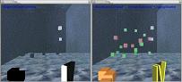
Below are some snapshot of the systems I have been obtaining capture
data from. My sesame page is
here
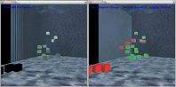
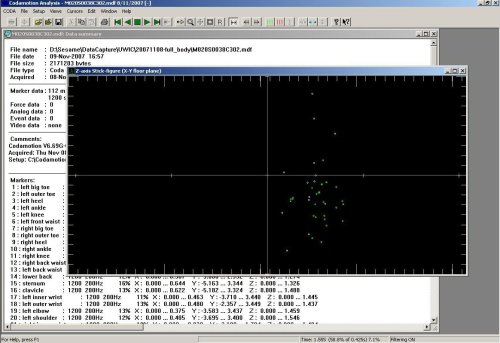
| Motion Capture Analysis
using Coda System |
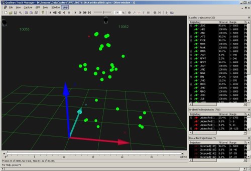
Motion Capture Analysis
using Qualisys QTM |
 |
 |
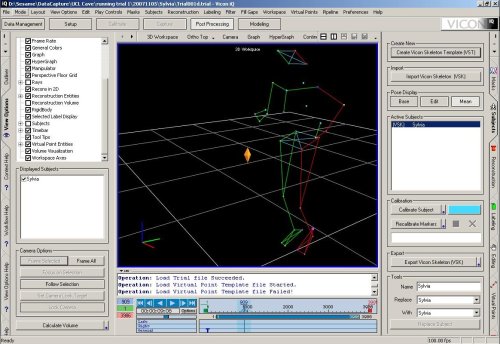
| Motion
Capture Analysis and Editing using Vicon IQ |
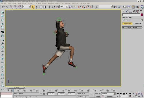
Character Animation
using 3D Studio Max |
 |
 |
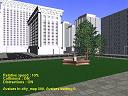
Equator
IRC [2004-2007]
My research interests in this
project were mobile services,
user
interfaces, 3d visualisation and collaboration.
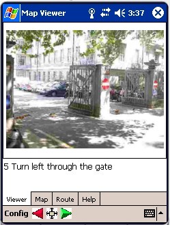
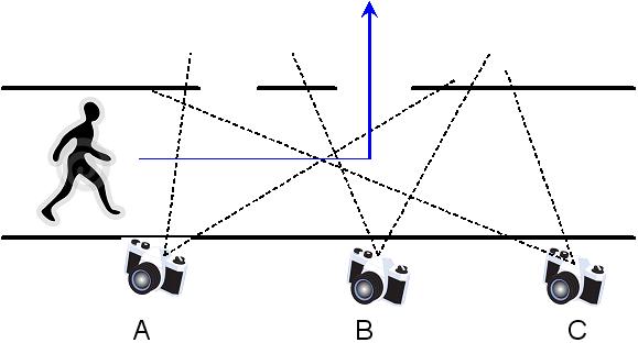
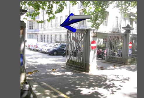
I led UCL's contribution to the equator project by exploring a new
field of augmented pedestrian navigation systems.
Project contributions:
• Photo based
pedestrian
navigation system using non-landmark photographs
• Pioneering development of
Augmented photo-based pedestrian navigation
• Design of Geo-Tagging system
architecture used to develop application on PDA (used in Chawton House)
• Design and development of
mapping and navigation system on .NET platform
• Implementation of PDA based
system to interface with ECG monitoring device
• Adaptation of the george
square system to UCL porting to Linux and PDA
• Extended the George Square
system to apply
visibility processing to prioritize recommendations that are probably
visible to the user based on real geometry from maps.
• Design of content creator for
the GS system (emphasis on photo and visibility of buildings)
• C# .NET CF port (rather
reimplementation) of GSQ-pocket PC version
• Mapservices for on the fly map
generation from spatial databases (Oracle and postgis)
Long-Term
Habitat Ergonomics
for Mars Mission [2004]
I worked on the 3d model used for the simulation of long-term habitat
during the Mars mission. The work was done in collaboration with
mission specialists, astronauts and simulation experts from ESA and
SAS (Belgium).
PhD
The work focusses on the
development of a novel and principled
solution for optimising the network usage of any arbitrary highly
animated and populated distributed virtual environment. This is
performed with the ultimate goal of reducing the effect of inherent
networking problems such as bandwidth limitation, congestion and lag,
on the user's perceptual experience of the virtual environment. The aim
is to prioritise
updates being dispatched by the server to the user's viewer, in a
client-server
architecture, such that the most perceptually significant updates are
sent as soon as possible, whilst the remaining updates are sent subject
to the level of network traffic.
The work investigates the
theories and findings in the field
of
visual attention from experimental psychology and, more recently, from
computer graphics and a few other related fields, with the main aim of
developing a computationally viable visual attention model applicable
to dynamic and interactive computer generated environments. For this
purpose, the features and intrinsic characteristics of what makes a
virtual environment different from other computer generated worlds and
animations are analysed with strong emphasis on the user's perspective.
Building on these findings, a visual attention model comprising of a
top-down and bottom-up component is devised, to represent the principal
mechanisms which leads to selection of regions of a scene for further
scrutiny and also which contributes to the user's overall sense of
perceptually plausible environment.
A set of experiments are
carried out to investigate some of
the most
significant observations about visual attention within the VR context,
with the aim to tune and improve the attention model. These include a
number of low-level psychophysical studies (to evaluate change
detection and inattention blindness) and task-performance study. Most
important observations are that colour and orientation changes are
visually more salient and only a limited number of changes can be
noticed simultaneously, if at all.An efficient implementation of
this model, which essentially
generates an attention map by combining feature-based maps and mental
maps, is evaluated through a set of experiments. Next, distributed VR
system architectures which use an implementation of the attention model
are conceived, weighting the impact on system resources, network and
user perception. The network usage and user's perception is evaluated
using experimental test-beds of animated and populated distrib uted
virtual environments.
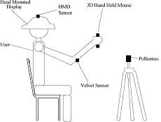
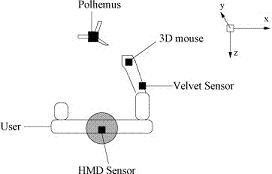
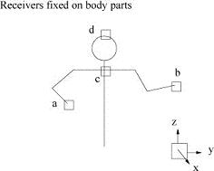
MSc
In this project, we developed
an approach to interactive
control of
avatars in virtual environments, using an artificial neural network.
The network captures the essential characteristics of real human
motion, and is subsequently employed to create credible body postures
from a minimal set of sensor inputs.
The technique offers an
alternative to inverse kinematics for
human
figure control. A
generalised network, trained by a population of users, can be used
successfully for individuals by
scaling the avatar’s body to match each real
human’s body dimensions.
It is demonstrated that the
network can predict arm positions to an accuracy better than the errors
which human subjects can
detect.