
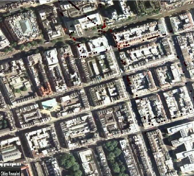
Carbonmonoxide data from the DAPPLE site on Marylebone road was collected over a period of two weeks by a group from UCL. The first week of data collection coincided with week 2 of the DAPPLE project, starting on Tuesday 4 May 2004 and finishing on Monday 10 May 2004, excluding the weekend. During this week, data was collected by walking along the pavements carrying pollution logging equipment. The next week of data collection stated on Monday 17 May 2004 and finished on Friday 21 May 2004, coinciding with DAPPLE week 5. This week was intended to be mainly cycling, but, due to a shortage of experienced cyclists, it became a combination of walking and cycling.
Click on any of the images to see the full size picture.


For the Green, Red and Yellow packs, the following equipment was available:
For the Blue pack, the following equipment was available:
In use the equipment is placed in a rucsack to allow hands free operation, with the GPS aerials attached to the top of the pack with Velcro. All the pollution monitors are in a pocket open to the air on the right hand side of the pack, unless otherwise noted. It is possible to place two packs of equipment into one rucksack and have a pollution monitor on both the left and right sides.
The HAICOM GPS units were always used with external aerials fitted, unless specifically noted in the log. These GPS devices should get a fix within about a minute of being switched on, while the white box types take a lot longer.
In use, the ICOM units appear to give some artificially high CO readings immediately afer being switched on. For this reason, any readings taken in the first 20-30 seconds are unreliable.
gpslog_06-05-2004_104008.txt
log_06-05-2004_104008.txt
In this case, the GPS log and the sensor log were started on 6 May 2004 at 10:40 and 8 seconds. The following is a section from one of the log files:
527846.29 181944.89 1083850772 1083847154 1.6 0.7 19.6 12.0
527845.03 181944.12 1083850773 1083847155 1.6 0.7 19.6 12.0
527845.03 181944.12 1083850774 1083847155 1.6 0.8 19.6 12.0
527842.25 181944.42 1083850775 1083847157 1.6 0.8 19.6 12.0
527842.25 181944.42 1083850776 1083847157 1.6 0.8 19.6 12.0
527842.25 181944.42 1083850777 1083847157 1.6 0.8 19.6 12.0
527839.75 181947.32 1083850778 1083847160 1.6 0.7 19.6 12.0
527839.02 181948.41 1083850779 1083847161 1.6 0.7 19.6 12.0
The meaning of the various fields are as follows:
| Position | Example | Description | |
|---|---|---|---|
| 1 | 527846.29 | Current East coordinate from the GPS in OSGB coordinates, or -1 if there was no GPS fix. | |
| 2 | 181944.89 | Current North coordinate from the GPS in OSGB coordinates, or -1 if there was no GPS fix. | |
| 3 | 1083850772 | The time of the sample taken from the PDA's internal clock. | |
| 4 | 1083847154 | The time of the last GPS fix from the GPS device, or -1 if the time could not be read. It is possible to get a GPS time, but no position data in which case the East and North coordinates are both -1. | |
| 5 | 1.6 | The raw carbonmonoxide reading from the ICOM device, or -1 if the device could not be read. | |
| 6 | 0.7 | The base carbonmonoxide value from the ICOM device, or -1 if the device could not be read. | |
| 7 | 19.6 | The temperature of the sensor in the ICOM device in Celsius, or -1 if the device could not be read. | |
| 8 | 12.0 | The current voltage of the internal battery in the ICOM device, or -1 if the device could not be read. |
NOTE: In order to calculate the true carbonmonoxide amount, it is necessary to take the raw carbonmonoxide reading and subtract the base value. For example, from the first line of the log file above, 1.6 - 0.7 = 0.9.
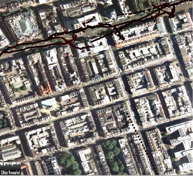
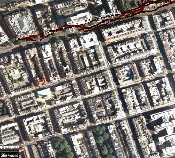
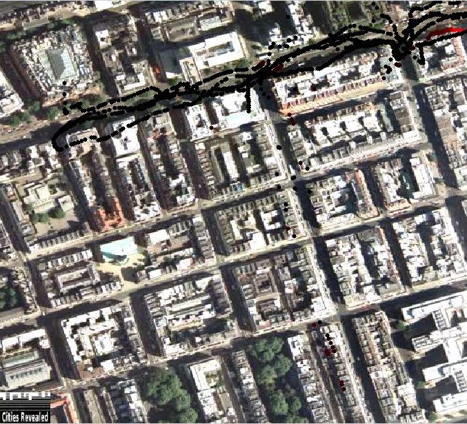
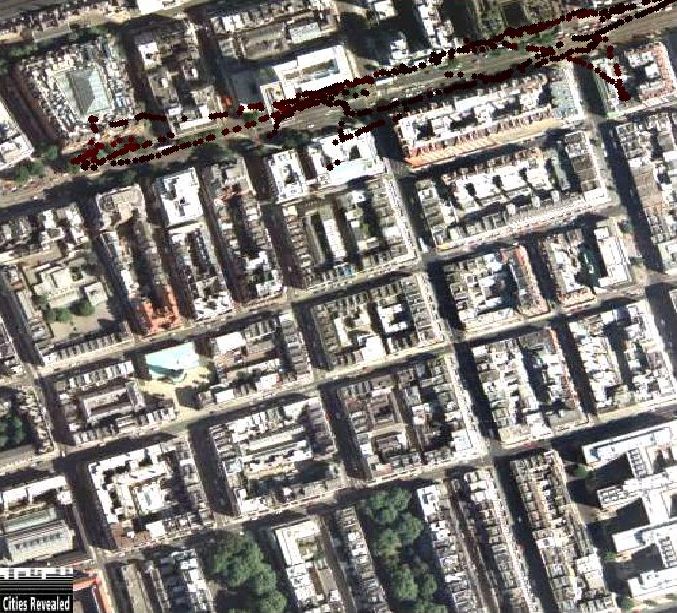
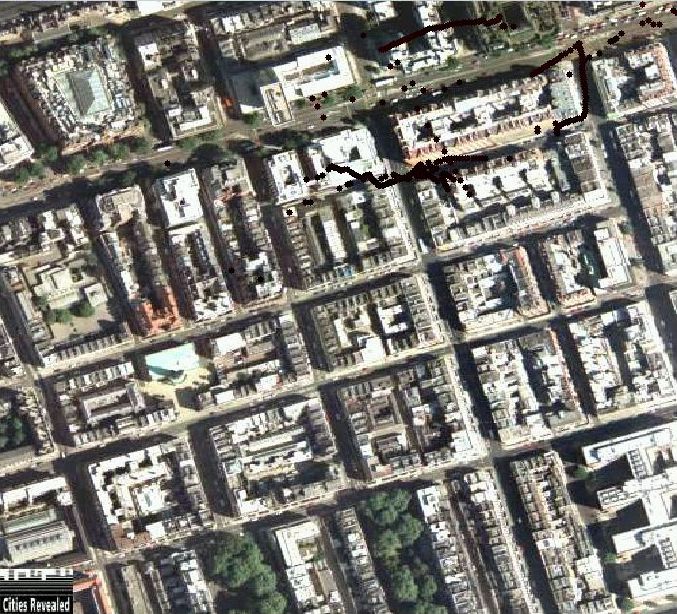
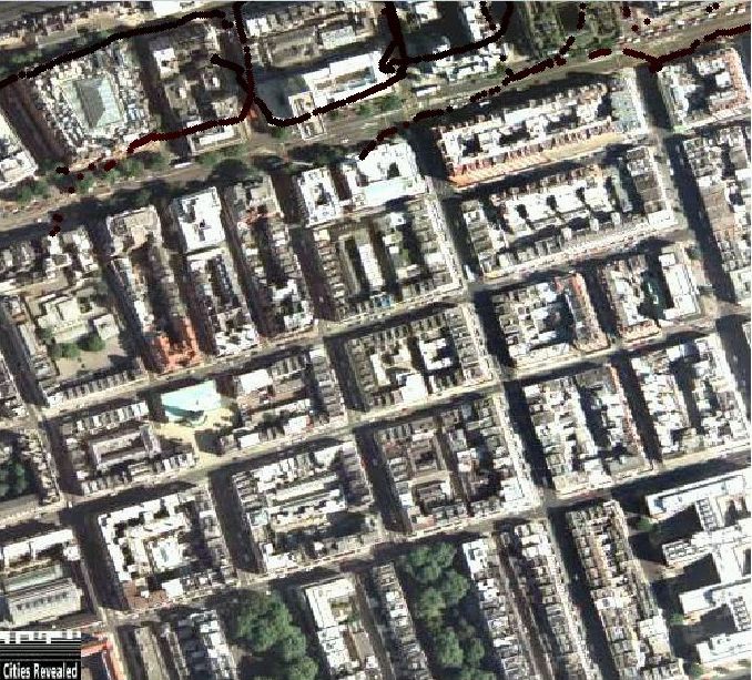
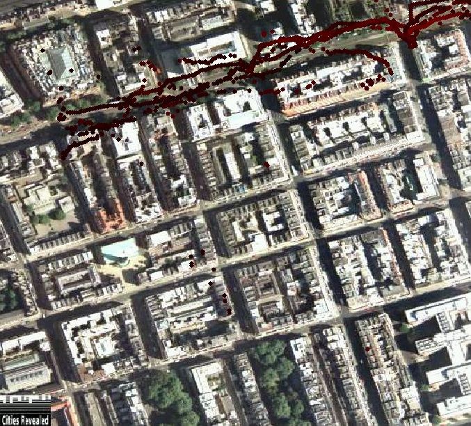
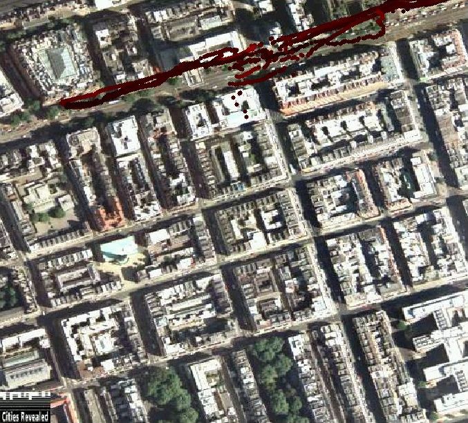
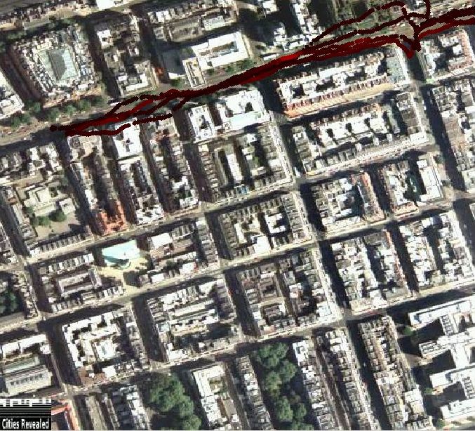
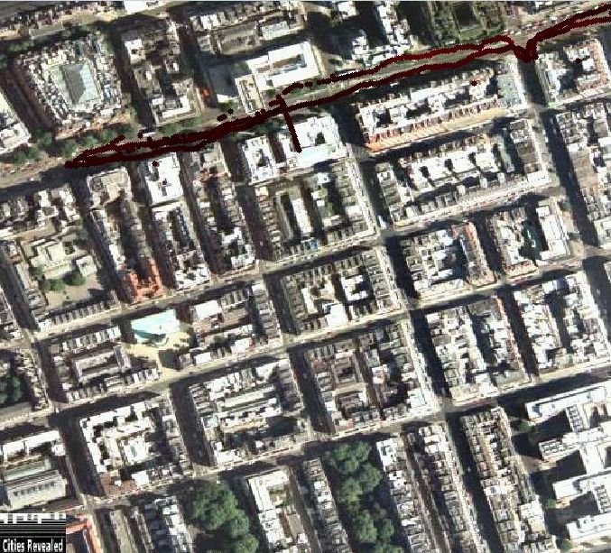
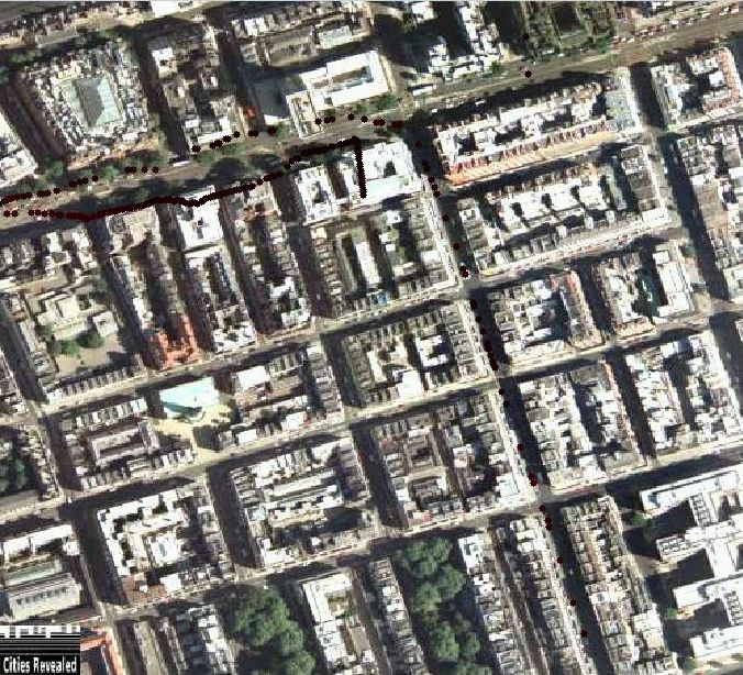
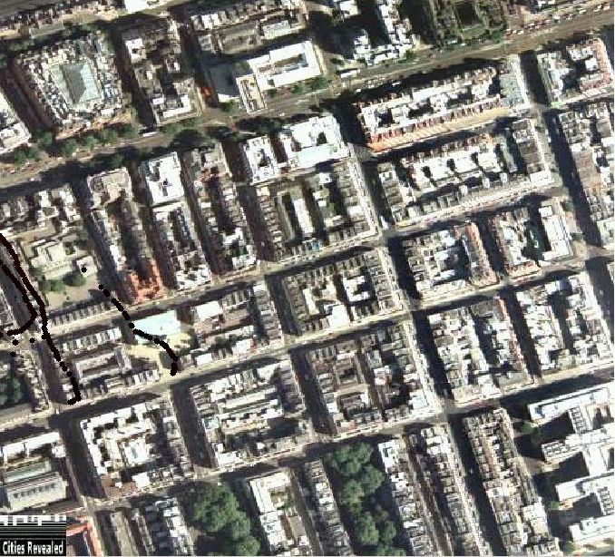
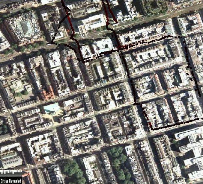
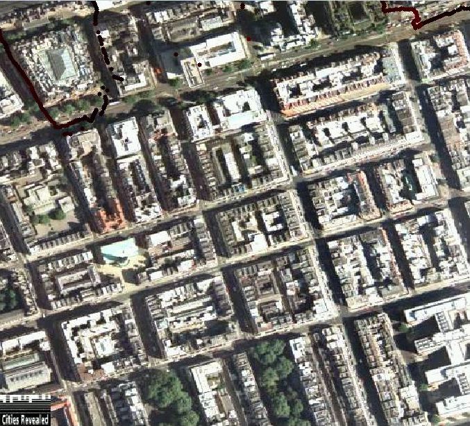
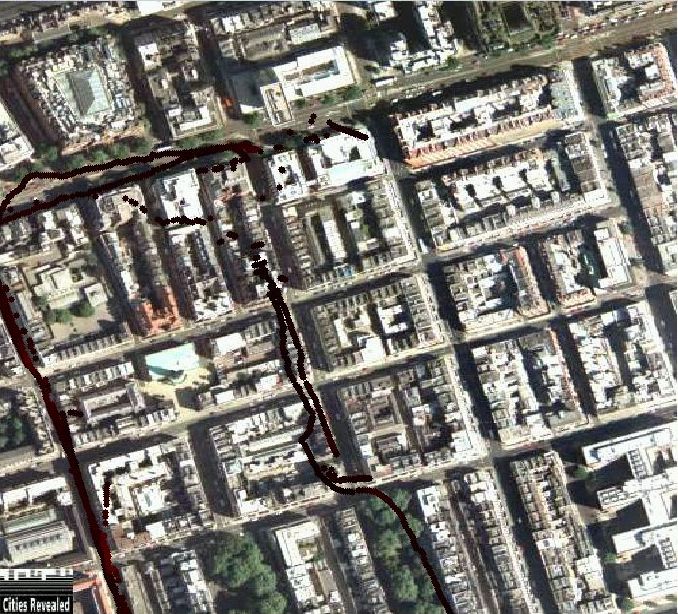
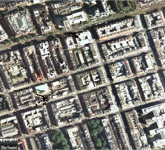
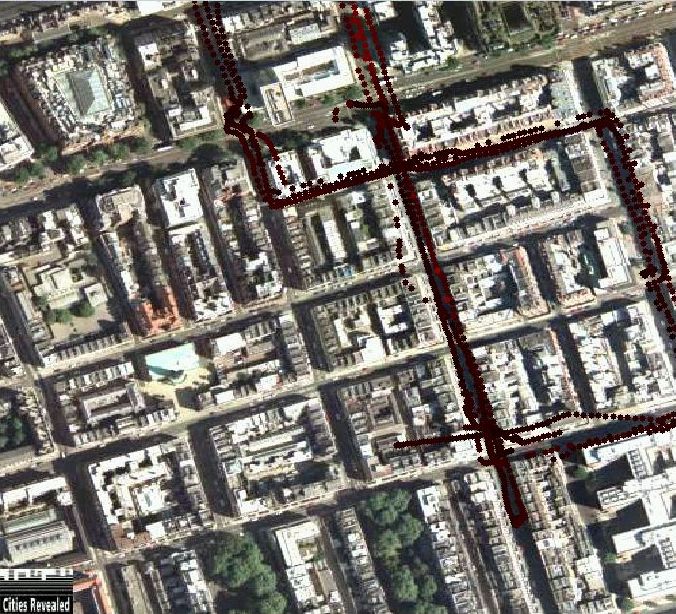
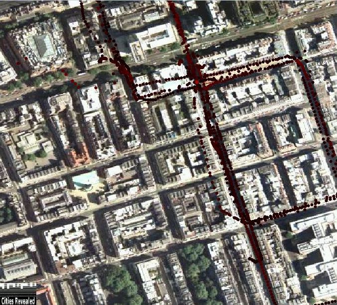
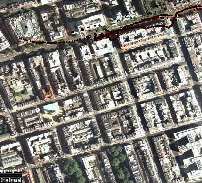
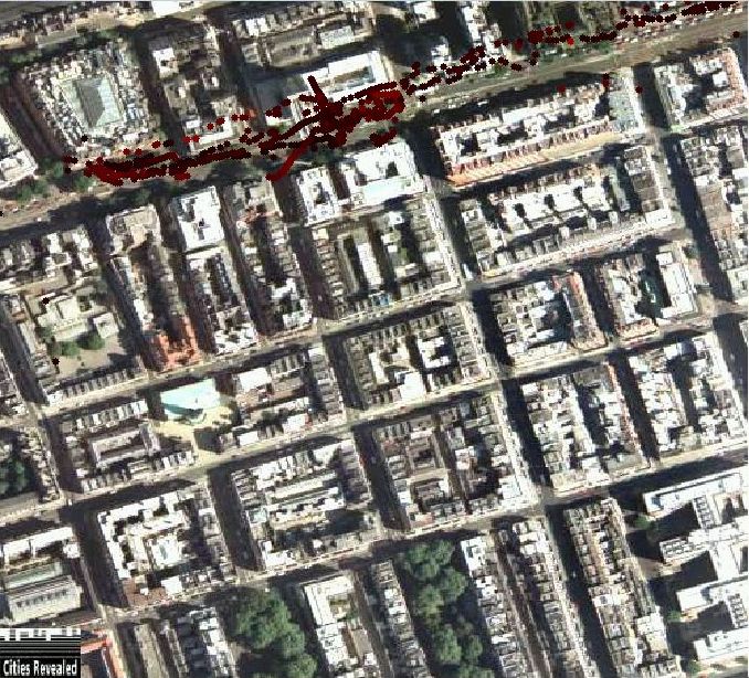
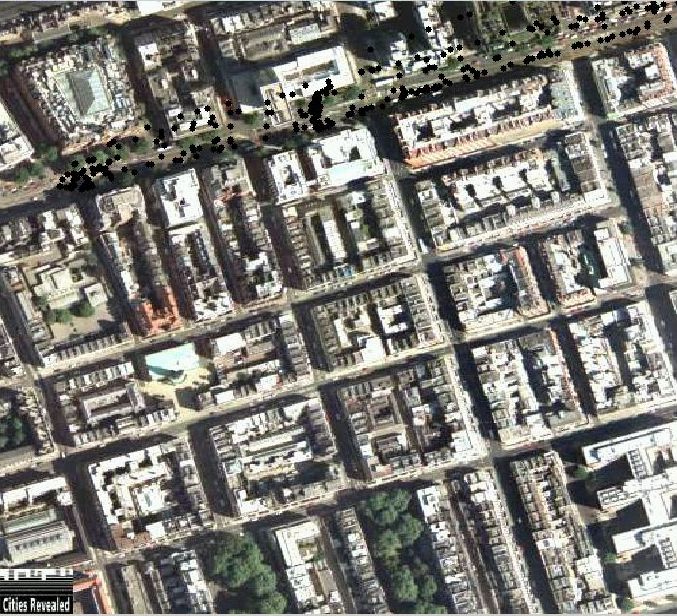
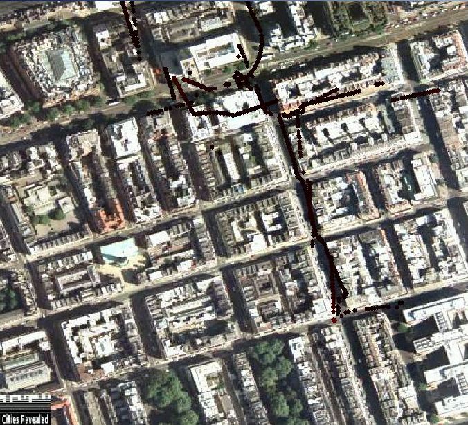
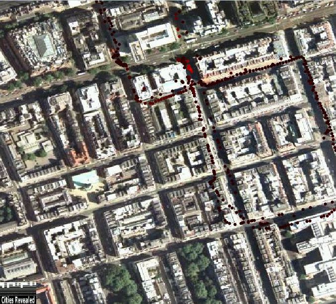
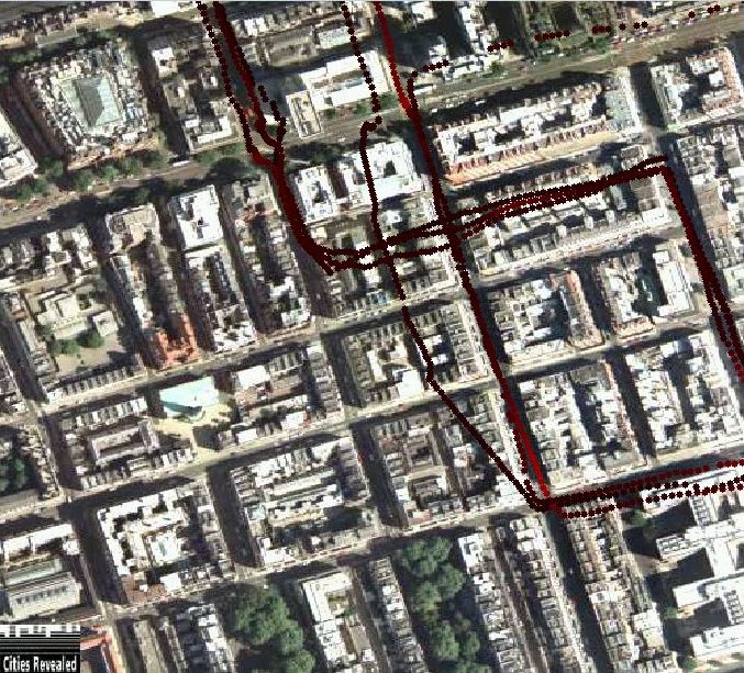
The two DAPPLE walking routes are on either side of Marylebone road. On the North side, which is the Baker Street tube station side, the route starts at the traffic lights outside the Landmark Hotel and continues along Marylebone Road, finishing at the traffic lights after the tube station but before crossing over to the Madame Tussauds side.
The other walking route is on the South side of Marylebone road, which is the side Westminster council is on. The route is parallel to the previous route on the North side, starting and finishing at the same points on the opposite side of the road. The route begins opposite the Landmark Hotel, on the South side of the road beside the junction with Enford Street and then continues along Marylebone road until the public lavatory outside Westminster University, just after Chiltern Street.
Both routes can be walked in either direction and, using a walker on each side of the road, comparisons between the North and South sides of Marylebone Road can be made. The direction of walking is noted in the experiment log, but can be seen visually from the GPS traces.
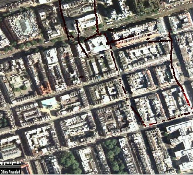
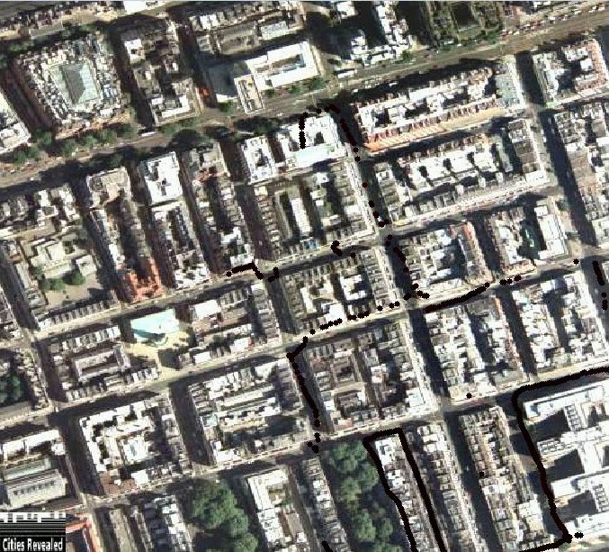
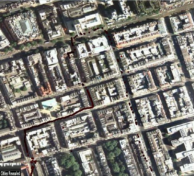
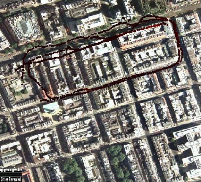
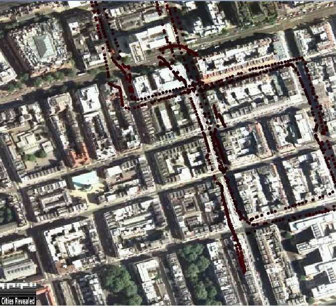
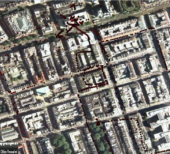
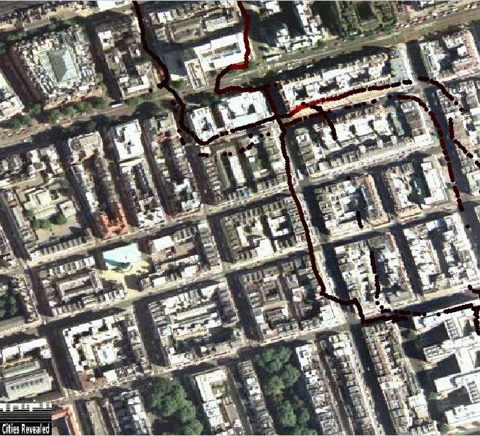
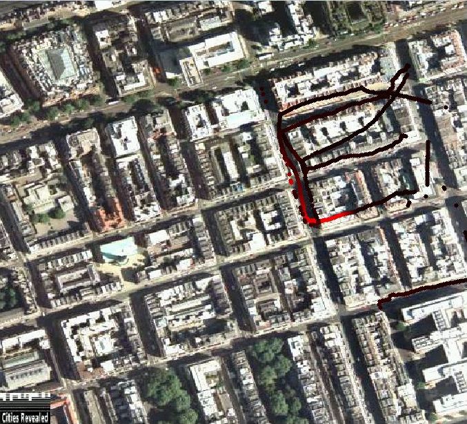
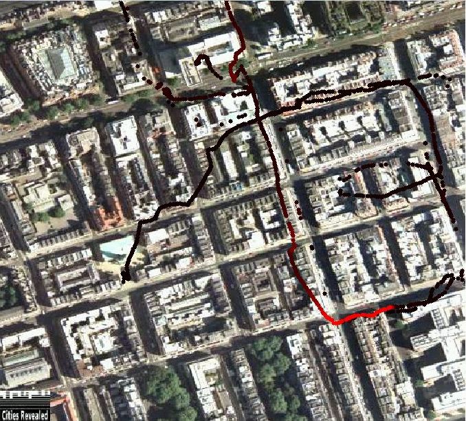
The cycle route is more complicated, making a figure eight with Westminster Council at the centre. The route starts at the Montagu bus stop on Gloucester Place. Cyclists then cycle North up Gloucester Place, which is a one way street. On reaching the junction with Marylebone Road, they cycle straight across, continuing along Gloucester Place until the second left turn into Dorset Square, going around the North side of the square anticlockwise, joining Balcombe Street as the route heads South. They then walk across the junction with Marylebone Road, into Upper Montagu Street briefly before turning left into Salisbury Place and cycling around the back of Westminster Council. At the junction with Gloucester place they cross into Bickenhall Street and cycle along until turning right into Baker Street. They cycle South down Baker Street finally turning right into Dorset Street. At the end of Dorset Street is the finish point at the junction with Gloucester Place. From there, the cyclists either stop, or continue around for another circuit.
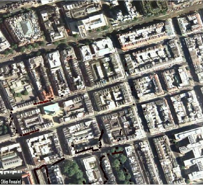
During the two weeks, the cycle route was covered by both cyclists and walkers, with one walker starting with the cyclist and another walker starting half way around the route. This is a very effective comparison of the difference between walking and cycling. Due to the one way streets, which are part of the cycle route, cyclists must always travel the same way round, while walkers can do the route in reverse. The direction of walking is noted in the experiment log and can be seen from the GPS data.
NOTE:
| Log File Time | Equipment | Route | Comment |
|---|---|---|---|
| 11:43:33 | Red, HAICOM GPS | Marylebone road walking route. | NO GPS |
| 12:14:38 | Red, HAICOM GPS | Walked along Marylebone road from the planetarium to the Landmark hotel and back twice. | EXTREMELY LITTLE GPS |
| 14:25:03 | Red, HAICOM GPS | Walked along underground side of road with red pack trying to find a GPS signal. Abandoned due to rain. | VERY LITTLE GPS |
| 14:49:30 | Red, HAICOM GPS | Marylebone road walking route. | NO GPS |
| 12:17:09 | Yellow, HAICOM GPS | Walked along Marylebone road south side from university to finish point and back twice. | NO GPS |
| 16:49:44 | Yellow, HAICOM GPS | Marylebone road walking route. | NO GPS |
| Log File Time | Equipment | Route | Comment |
|---|---|---|---|
| 11:45:10
View Image |
Green, White GPS | Walk along Marylebone road, crossing from side to side at every traffic island. | |
| 14:04:28 | Green, HAICOM GPS | Walked along Marylebone road on South side, staying next to Yellow pack for GPS comparison. | SOME GPS
Also see Green/Yellow Comparison |
| 15:14:53 | Green, HAICOM GPS | Walked along Marylebone road on North side. Abandoned due to rain after half a run. | SOME GPS |
| 10:35:56
View Image |
Red, White GPS | North side of Marylebone road. | CO peak 5.9ppm |
| 11:43:22
View Image |
Red, White GPS | Walked along Marylebone road on South side. | CO peak 13.1ppm, ICOM LEAD APPEARS TO HAVE COME LOOSE |
| 13:53:20 | Red, White GPS | Walked along Marylebone road on North side. | |
| 15:14:17 | Red, White GPS | Walked along Marylebone road on South side. Abandoned due to rain after half a run. | EXTREMELY LITTLE GPS |
| 10:37:23
View Image |
Yellow, White GPS | South side of Marylebone road. | |
| 11:44:33
View Image |
Yellow, White GPS | Walked along Marylebone road on North side. | |
| 13:52:39 | Yellow, White GPS | Walked along Marylebone road on South side, staying with Green pack for GPS comparison. | CO peak 14.4ppm
Also see Green/Yellow Comparison |
| Log File Time | Equipment | Route | Comment |
|---|---|---|---|
| 10:40:08 | Green, HAICOM GPS | Walked around sidestreets on Tube side. Regents park, Cornwall road, round Marylebone station. | SOME GPS |
| 11:58:36
View Image |
Green, HAICOM GPS | Walked around sidestreets on south side of Marylebone road. | |
| 14:08:02
View Image |
Green, White GPS | Walked around 10:40 route again due to no previous GPS fix. Regents park, cornwall road, Marylebone station. | |
| 15:23:46
View Image |
Green, White GPS | Walked around sidestreets on south side, behind council buildings. | |
| 10:35:25
View Image |
Red, White GPS | Walked along north side of Marylebone road. | CO peak 7.2ppm, higher peaks in file, but no GPS |
| 11:50:43
View Image |
Red, White GPS | Walked along south side of Marylebone road. | CO peak 4.5ppm |
| 14:06:38
View Image |
Red, White GPS | Walked along north side of Marylebone road. | CO peak 4.7ppm |
| 15:23:01
View Image |
Red, White GPS | Walked along north side of Marylebone road. | |
| 10:37:30
View Image |
Yellow, White GPS | Walked along south side of Marylebone road. | CO peak 6.7ppm |
| 11:51:29 | Yellow, White GPS | Walked along north side of Marylebone road. | NO GPS |
| 14:07:12
View Image |
Yellow, White GPS | Walked along south side of Marylebone road. | |
| 15:22:37
View Image |
Yellow, White GPS | Walked along south side of Marylebone road. |
| Log File Time | Equipment | Route | Comment |
|---|---|---|---|
| 11:00:20 | Green, HAICOM GPS | Walked around DAPPLE cycle route, together with another walker carrying the Red pack to give GPS a comparison. | Also see Green/Red Comparison |
| 11:43:54 | Green, HAICOM GPS | Walked around Edgware road, Seymour road, Gloucester Place twice. | |
| 13:26:24
View Image |
Green, HAICOM GPS | Walked around streets close to council on south side. | |
| 14:57:17
View Image |
Green, HAICOM GPS | Walked a zigzag path down streets between Gloucester Place and Baker street, working south. | |
| 10:59:40
View Image |
Red, White GPS | Walked around DAPPLE cycle route, together with another walker carrying the Green pack to give GPS a comparison. | CO peak 7.2ppm
Also see Green/Red Comparison |
| 11:43:03
View Image |
Red, White GPS | Walked to Regents park, around north of Marylebone station and back via Lisson Grove. | CO peak 4.9ppm |
| 13:25:08
View Image |
Red, White GPS | Walked to Mme Tussauds, Marylebone high street, Wigmore St, Baker St. | |
| Log File Time | Equipment | Route | Comment |
|---|---|---|---|
| 10:02:59 | Green, White GPS | Walked round cycle route. | NO GPS |
| 10:56:52 | Green, White GPS | Walked up and down roads on south side of Marylebone road including Seymour Place, Enford Street, Wyndham Street, Knox Street, Upper Montagu Street, round the back of the council, Durweston Place and mews leading south from behind council down Montagu Square and back up Gloucester Place. | NO GPS |
| 12:03:57
View Image |
Green, White GPS | Walking to spire at intersection of Enford Street and York Street, walked loops around Old Marylebone Road, Seymour Place, Crawford Street, Homer Street, Harcourt Street and square around Montagu Street, Crawford Street, Seymour Place, York Street, circling spire. | |
| 13:37:07 | Green, White GPS | Walked down Baker Street and Gloucester Place working south and crossing between the two streets via the interconnecting roads including Bickenhan Street, York Street, Crawford Street, Dorset Street, Blandford Street, George Street, Portman Close and walked past CO car park vents in Rodmarton Street. | NO GPS |
| 14:23:30
View Image |
Green, White GPS | Walked down Upper Montagu Street, around Montagu square and covered roads connecting Gloucester Place to Baker Street including George Street, Dorset Street and Crawford Street. | |
| 15:39:17
View Image |
Green, White GPS | Walked round cycle route. | |
| 10:52:03
View Image |
Red, White GPS | Walked round Gloucester Place, Upper Montagu Street, Crawford Street, Seymour Place. | |
| 12:01:13
View Image |
Red, White GPS | Walked between roads connecting Baker Street to Gloucester Place. | |
| 14:16:34
View Image |
Red, White GPS | Walked down Marylebone road towards Planetarium, continued on to Regents Park, walked around park, along road north of Marylebone station and returned via Harewood avenue and circled station. | |
| 15:39:05
View Image |
Red, White GPS | Walked along Marylebone road towards park, walked round roads on North side of Marylebone road. | CO peak 4.7ppm |
| 10:50:59
View Image |
Yellow, White GPS | Walked a square route down Marylebone road, Baker Street, York Street, Enford Street and back onto Marylebone Road. | CO peak 5.5ppm |
| 12:01:11
View Image |
Yellow, White GPS | Walked along north/south connecting roads inside Marylebone Road, Baker Street, York Street, Enford Street circuit. | |
| 14:16:18
View Image |
Yellow, White GPS | Walked along Marylebone road to Seymour Place, went down Seymour Place to George Street, along George Street to Montagu Square, then north along Upper Montagu Street back to Marylebone Road. | |
| 15:38:48
View Image |
Yellow, White GPS | Walked Marylebone Road, Enford Street, York Street, Baker Street circuit, also walking down Gloucester Place and further south on Baker Street to Dorset Street. | |
NOTE:
| Log File Time | Equipment | Route | Comment |
|---|---|---|---|
| 11:27:40
View Image |
Green, HAICOM GPS | Static location at intersection with start/end of cycle route. | SOME GPS
Also see CO Graph |
| 14:36:54
View Image |
Green, HAICOM GPS | Walked around roads immediately south of council and around church spire. | |
| 15:32:42 | Green, HAICOM GPS | Walked home along Marylebone road, right at Warren street tube, hospital street into UCL. | VERY LITTLE GPS |
| 14:32:32
View Image |
Yellow, White GPS | Walked around the Old Marylebone Road, Seymour Road, Edgware road route (once). | |
| 11:09:53
View Image |
Red, White GPS | Cycled 3 times round cycle route. | |
| 14:03:48
View Image |
Red, White GPS | Cycled around cycle route, then other cycle routes around area. | CO peak of 8.7ppm |
| 15:31:50
View Image |
Red, White GPS | Cycled around Baker street area, then headed back to UCL along Marylebone road. | |
| 11:10:45
View Image |
Yellow, White GPS | Cycled 3 times round cycle route. | |
| 15:31:53 | Yellow, White GPS | Cycled around Baker street area, then headed back to UCL along Marylebone road. | |
| 10:15:15 | Blue, HAICOM GPS | Cycled 3 times round cycle route. | |
| 11:08:39
View Image |
Blue, HAICOM GPS | Cycled around cycle route. | High CO values, peak 16ppm |
| 14:07:32 | Blue, HAICOM GPS | Cycled around cycle route. | |
| 15:31:39 | Blue, HAICOM GPS | Cycled around Baker street area, then headed back to UCL along Marylebone road. | |
| Log File Time | Equipment | Route | Comment |
|---|---|---|---|
| 10:40:48 | Green, White GPS | Walked around cycle route starting at council, crossing into Gloucester place, heading for Dorset square turning (about half way round route). | |
| 11:56:25
View Image |
Green, White GPS | Walked around George Street and Bryanston and Montagu Square. | |
| 14:08:40
View Image |
Green, White GPS | Walking route on Marylebone road, council side, switched sides at 14:30, did not change log files. | |
| 15:11:46
View Image |
Green, White GPS | Started walking back to UCL (also with Yellow), found Baker street open, took circle line to Euston square and walked back to UCL from there. | |
| 10:37:39 | Yellow, White GPS | Walked around cycle route starting at start position. | NO GPS |
| 11:52:03
View Image |
Yellow, White GPS | Walked around roads near Marylebone station on north side of street. | |
| 14:08:01
View Image |
Yellow, White GPS | Walking route on Marylebone road, Baker street side, switched sides at 14:30, did not change log files. | |
| 15:11:25 | Yellow, White GPS | Started walking back to UCL (also with Green), found Baker street open, took circle line to Euston square and walked back to UCL from there. | NO GPS (only 6 lines in file) |
| 10:37:16
View Image |
Red, White GPS | Cycled around cycle route. | |
| 11:53:01
View Image |
Red, White GPS | cycle Marylebone road (left), turn Seymour Place, turn George Street, turn Gloucester Place and back onto Marylebone road. Also roads around George Street. | |
| 14:04:16
View Image |
Red, White GPS | Cycled up and down Marylebone road on walking route to test difference between walking beside the road and cycling in the road. POLLUTION LEAD APPEARS TO HAVE COME LOOSE PART WAY THROUGH ROUTE. | |
| 14:54:56 | Red, White GPS | Cycled back to UCL. Noticed pollution lead loose and replaced it. |
| Log File Time | Equipment | Route | Comment |
|---|---|---|---|
| 10:31:33
View Image |
Green, White GPS | Walked round cycle route starting at halfway point (council position). | |
| 11:48:27
View Image |
Green, White GPS | Walked round cycle route starting at council position. | |
| 14:24:46 | Green, White GPS | Walked round Marylebone road walking route, crossing at lights to be in same direction as traffic. | NO GPS |
| 15:21:53 | Green, White GPS | Baker street and York road square route, and round council building. | NO GPS (malfunctioning?) |
| 10:32:27
View Image |
Yellow, White GPS | Walked round cycle route starting at start position. | Short CO peak of 7.9ppm |
| 11:47:14 | Yellow, White GPS | Walked round cycle route starting at start point. | NO GPS (only 9 lines in file) |
| 15:12:37
View Image |
Yellow, White GPS | Walked round Baker Street, Gloucester Place and York street, going down various interconnecting roads. | CO peak 12.4ppm |
| 09:36:19 | Blue, Red pack's White GPS | Cycled from UCL to Westminster council. | SOME GPS |
| 10:13:52 | Blue, Red pack's White GPS | Cycled round cycle route. | |
| 10:31:04
View Image |
Blue, Red pack's White GPS | Cycled round cycle route. | Large CO trace with peak of 9.2ppm on Crawford St/Gloucester Place corner. Partial data for two loops. |
| 11:48:50
View Image |
Blue, Red pack's White GPS | Cycled round cycle route, then back to UCL. | CO peak 7.3 ppm, two large traces on Gloucester Place |
| 13:46:28 | Blue, Red pack's White GPS | Cycled from UCL back to Westminster council. | |
| 14:19:26
View Image |
Blue, with Red pack's White GPS | Cycled up and down Marylebone road, turning round at lights at either end of walking route. | CO peak 8.4ppm |
| 15:14:35 | Blue, Red pack's White GPS | Cycled round cycle route twice and then back to UCL. |
| Log File Time | Equipment | Route | Comment |
|---|---|---|---|
| 10:43:34
View Image |
Green, White GPS | Walked round Baker street, York Street, Gloucester Place. | |
| 11:50:07
View Image |
Green, White GPS | Baker street to Sherlock Holmes, back of Baker street station and Gloucester place. | |
| 12:50:28 | Green, White GPS | Green pack on right and yellow pack on left. Walked various roads on south side of cycle route. Returned just as it rained. | NO GPS |
| 15:19:30 | Green, White GPS | Green pack on right and yellow pack on left. Walked up and down Baker street and Gloucester road and connecting roads. Also visited tall church in York place. No GPS signal for whole route and problems opening COM port 2 on yellow pack. | NO GPS, SMALL FILE |
| 10:47:06
View Image |
Yellow, White GPS | Walked round cycle route starting at start point. | |
| 11:48:20 | Yellow, White GPS | Walked round various connecting roads on south side of cycle route. | NO GPS, SMALL FILE |
| 14:36:07 | Yellow, White GPS | Green pack on right and yellow pack on left. Walked various roads on south side of cycle route. Returned just as it rained. | NO GPS, SMALL FILE |
| 15:20:11 | Yellow, White GPS | Green pack on right and yellow pack on left. Walked up and down Baker street and Gloucester road and connecting roads. Also visited tall church in York place. No GPS signal for whole route and problems opening COM port 2 on yellow pack. | NO GPS, SMALL FILE |
| 10:41:01
View Image |
Red, White GPS | Cycled round cycle route. | |
| 11:49:18
View Image |
Red, White GPS | Cycled round cycle route. | NO GPS, SMALL FILE |
| 13:50:09 | Red, White GPS | Cycled round cycle route 4 times, returning just before the rain. | NO GPS, SMALL FILE |
| 14:33:55 | Red, White GPS | Cycled round cycle route 4 times. | NO GPS, SMALL FILE |
| 10:24:10 | Blue, HAICOM GPS | Flat Battery in ICOM, returned to UCL | VERY LITTLE GPS |
| Log File Time | Equipment | Route | Comment |
|---|---|---|---|
| 10:32:55 | Green, White GPS | Walked round cycle route starting at start point. | SOME GPS, SMALL FILE |
| 11:45:30 | Green, White GPS | Walked round cycle route starting at council. | NO GPS |
| 13:56:50 | Green, HAICOM GPS without external aerial | Red PDA, Red ICOM on left of pack, green ICOM on right. Walked once round cycle route, returning just as it started to rain. | NO GPS, SMALL FILE |
| 14:43:27 | Green on left of pack, HAICOM GPS with external aerial | Green ICOM on left of pack with HAICOM GPS. Red pack with white box GPS, Red PDA with red ICOM on right of pack. Walked to church tower, waited for GPS fix, then headed for cycle route at back of council. Walked twice round route from there, with a detour down Montagu street/Baker street as I was catching Kumardev. | CO peak 4.6 ppm.
Also see Red/Green Comparison |
| 13:55:13 | Red, White GPS | Red PDA, Red ICOM on left of pack, green ICOM on right. Walked once round cycle route, returning just as it started to rain. | |
| 14:44:39
View Image |
Red, White GPS | Green ICOM on left of pack with HAICOM GPS. Red PDA with red ICOM on right of pack. Walked to church tower, waited for GPS fix, then headed for cycle route at back of council. Walked twice round route from there, with a detour down Montagu street/Baker street as I was catching Kumardev. | CO peak 48.4ppm around Dorset Street, Gloucester Place corner!
Also see Red/Green Comparison |
| 10:33:21 | Yellow, White GPS | Walked round cycle route starting at council. | NO GPS, SMALL FILE |
| 11:45:03 | Yellow, White GPS | Walked round cycle route starting at start point. | EXTREMELY LITTLE GPS |
| 14:42:23
View Image |
Yellow, White GPS | Walked to church tower, waited for GPS then headed for cycle start point. Walked twice round cycle route from there. | CO peak 4.4ppm |